


With morning temperatures on Monday expected to be below zero, all six Johnson County public school districts preemptively announced on Sunday that classes would be canceled.
The National Weather Service’s Kansas City field office said that Monday was likely to start out with air temperatures between -5 and -10 degrees, with wind chills as cold as -25 degrees.
Dangerously cold temps tonight into Monday AM. Lows -5 to -10 with wind chills near -25. A Cold Weather Advisory is in effect through late Monday AM. Temps moderate later this week but remain well below normal. pic.twitter.com/W3U8CXkADk
— NWS Kansas City (@NWSKansasCity) January 25, 2026
“Due to expected refreezing and black ice, Monday, January 26, 2026 will be a Plan A Day. All Shawnee Mission School District schools and facilities will be closed including YMCA and JCPRD Daycare,” the Shawnee Mission district announced.
A “Plan A” day for Shawnee Mission all district facilities will be closed. Announcements about after-school activities and athletics on Monday will be made that day, the district said.
Other local districts made similar announcements, including Blue Valley, Gardner Edgerton, Olathe, Spring Hill and USD 232 in De Soto.
USD 232’s announcement cited the “bitter and dangerous Arctic cold,” plus the possibility of ice forming on area roadways on Monday morning.
Original story continues below:
Snowfall totals on Saturday fell short of some forecasts but still hit records, and the National Weather Service says there’s still more to come.
On Saturday evening, the National Weather Service reported slightly more than 4 inches falling at Kansas City International Airport, which would be the highest recorded total for Jan. 24 in the area.
Across Johnson County, snowfall totals reported before 4 p.m. ranged from an inch and a half in Prairie Village to two and a half in Gardner.
Now, concerns turn to the persistent extreme cold. The National Weather Service said wind chill values in the metro could fall to -20 degrees Sunday night and still be below zero Monday morning, when schools are set to return to session.
Plow trucks were out across the county since before the snow started on Friday and early Saturday morning, pre-treating and then plowing once accumulations began.
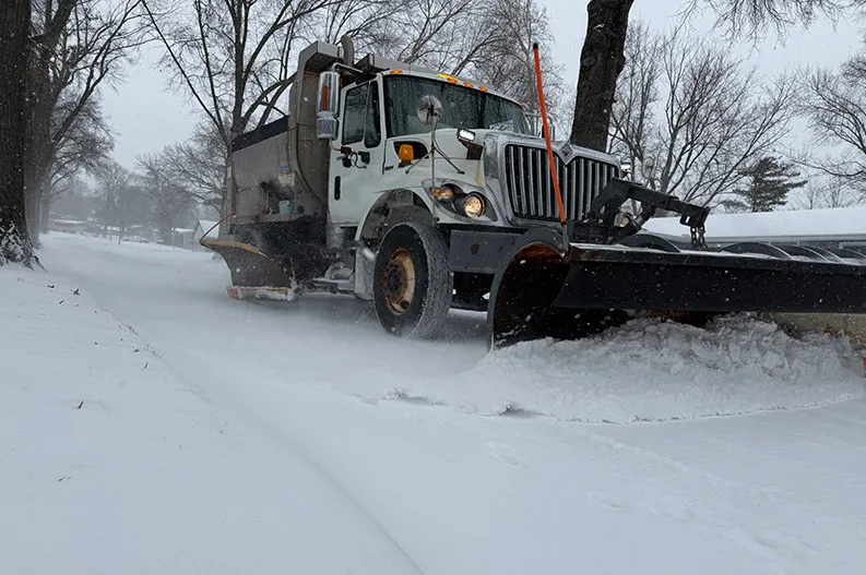
Many municipal public works departments posted updates on street-clearing progress on their respective city social media accounts — most of which remind residents that primary streets take priority over residential neighborhood plowing.
Snow-packed roads had caused more than 35 crashes, which had already been reported to local police. Many departments, such as Overland Park Police, have implemented walk-in reporting for non-injury crashes, in which drivers involved in minor crashes exchange information and file a police report after conditions improve.
In a news release, Overland Park Police Capt. Brian Houlahan said to exchange driver license information, current proof of insurance, make and model information for the involved vehicles, license plates and the location of the crash.
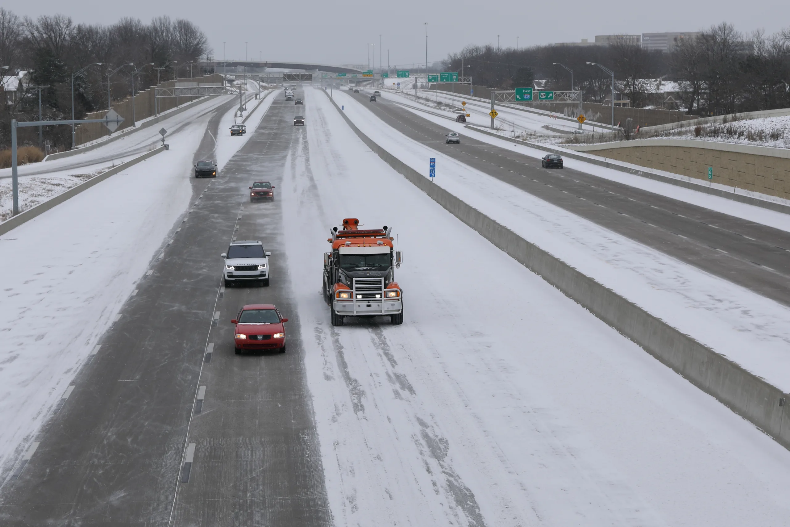
Johnson County and the rest of the metropolitan area remain in a winter storm warning until noon on Sunday.
Meteorologists at the local office of the National Weather Service in Pleasant Hill, Missouri, are expecting an additional 2 to 4 inches for the Johnson County area.
Up to 6 inches more is possible south and east of the KC metro by the time the flakes stop flying late Sunday morning.
With the fresh snowpack, wind chills are forecast to range between -10° and -20° on Monday morning.
Low temperatures next week are forecast to be in the single digits, with daytime highs staying below freezing through next Saturday.